
Ayas
The Land Registry
Catasto is a term of Greek origin derived from κατάστιχον, meaning “line by line” and, as can easily be inferred from the literal meaning, it is used to refer to a collection or register of assets, maps, and documents. The Cadastre par excellence is a sort of register of all the real estate assets located within the national territory.
The historical cadastral records of the Alpine areas are a fundamental tool for interpreting the landscape in its historical evolution, and knowledge of them forms an important basis for enhancing the historical and landscape heritage.
By comparing documents produced in different periods but representing the same territory, it is in fact possible to derive important information about the changes that have taken place over time.
The Sardinian Cadastre, commissioned by the House of Savoy as part of a survey of the lands of the Kingdom of Sardinia and drawn up in the Aosta Valley between 1767 and 1773 following the establishment, in 1762, of municipalities in the modern sense of the term, occupies a position of outstanding importance among the ancient documents of every municipality in the Aosta Valley, and is also particularly significant for the historical study of consorterie and their territorial extent. It was a truly immense undertaking considering the fragmentation of municipal land into small parcels and the consequently high number of plots to be surveyed. All parcels are identified in the cadastre by a sequential number, with an indication of the area, the taxable income for fiscal purposes, and neighbouring properties. Only for very large plots, such as consorterie, are the orographic boundaries indicated. Cultivated land is measured in toises (1 toise = 3.50 m²). The value of income from woods and uncultivated land is simply estimated, whereas that of mountain pastures used for grazing is assessed according to the number of cows taken there during the summer. The Sardinian Cadastre of Ayas, once managed by the Municipality and entrusted to the municipal secretary, who held the role of gardiateur du cadastre, is preserved in good condition in the municipal archives.
Despite the absence of maps, in the Aosta Valley the numbering of the parcels in the Sardinian Cadastre continued to be used for changes of ownership until 1904, the year in which the foundational Cadastre commissioned by the Italian State came into force (Messedaglia Law, 1 March 1886, no. 3682). The maps of the latter still form the land register basis for all notarial deeds today, since, for the first time, the complete parcel structure of the territory of the Aosta Valley was represented.
The foundational Cadastre was also fundamental for the survey of rural architecture carried out by the Aosta Valley Region and for the reconstruction of the agricultural landscape (1990s).
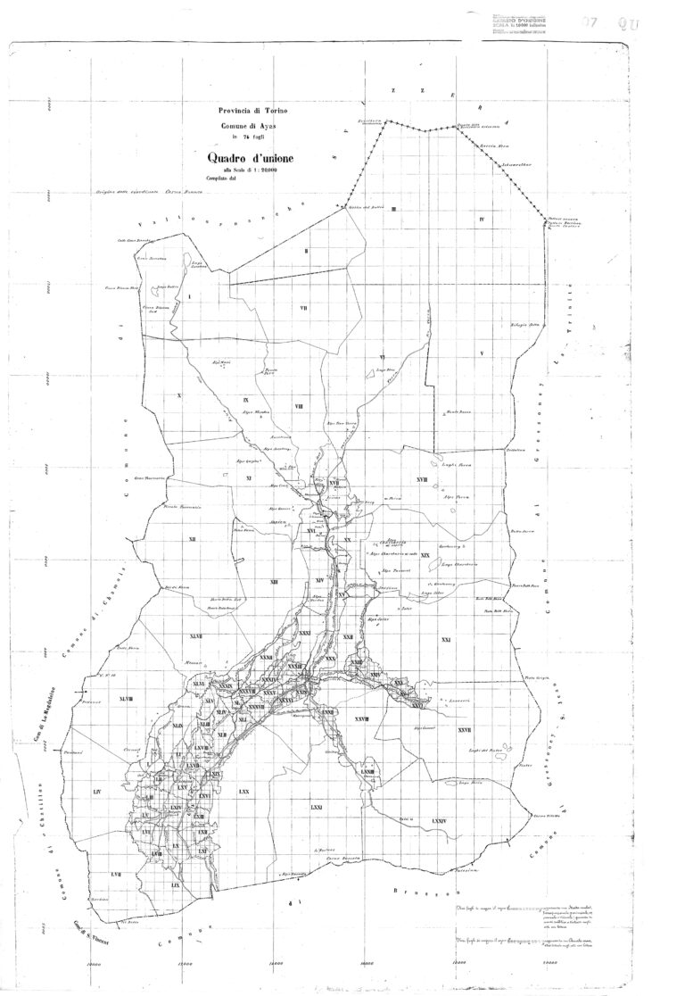
The introduction of the metric system, on the other hand, is attributable to the Napoleonic Cadastre, initiated in two phases during the brief period of French rule in Italy (in 1806 for masses of cultivated land at a scale of 1:5,000 for approximately twenty municipalities and, between 1811 and 1813, at a scale of 1:2,500 for the municipalities north of Aosta), but never completed. It was an incomplete undertaking (the Ayas Valley was not surveyed), which was never used for fiscal purposes, but which remains an exceptional archival document.
Bibliography
C.Remacle, N.Bétemps, Cadastres et territoires. Catasti e territori. Programma di iniziativa comunitaria Interreg. III A 2000-2006, ALCOTRA – Italia-Francia
S.Favre, Ayas. Antropologia di un territorio. Luoghi, leggende, storie, fatti, Priuli & Verlucca editori, 2020
S.Rollandin, Le consorterie di Ayas ed altri frammenti di storia locale, Association Valdôtaine Archives Sonores, Saint-Christophe, 2021